


Bloor Homes - Foxhall Road Development
Patti Mulcahy Question & Answer Sessions
Councillor Patti Mulcahy recently held two Question & Sessions in relation to planning. We've compiled the key takeaways for your viewing. Please the tap the button below to view the full outline.
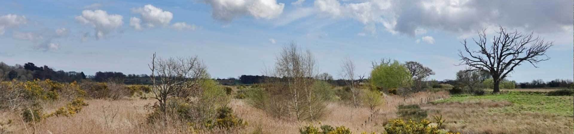
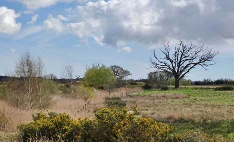
Bloor Homes: Proposed new homes off Foxhall Road
Bloor Homes are in the early stages of plans for around 1300 homes off Foxhall road.
No planning application has been submitted yet. The plans are still in the early stages, with an outline application anticipated for winter 2025/26.
The detailed plans — including aspects such as design, transport and infrastructure — are still being developed and will be refined based on feedback gathered during this engagement period.
Please see their Website for more information.
Help Us to Understand the Impact of Bloor Homes Proposed Development
We are asking for your input on how new housing developments are affecting our community’s infrastructure and environment.
We need your evidence and experiences regarding:
- Traffic congestion and public transport
- Access to schools, nurseries, GP surgeries and hospital appointments
- The state of our natural environment, with particular attention to priority species such as hedgehogs, bats and silver-studded blue butterflies
Your contributions, based on real life experiences will help us to demonstrate the challenges faced, and highlight the impact the new development on our community.
We request that if you have experienced difficulties with the local infrastructure, or spotted a priority species, to share the details with us. Please include as much detail as possible, including the date, time and location (with What3Words if possible) and a photo (if applicable) to support.
Please submit your findings by email at: enquiries@martleshamcouncil.org.uk
Thank you for your support.
Pre-application advice and baseline information from key authorities.
Bloor Homes has proposed a large-scale residential development of approximately 1,300 homes on land south of Foxhall Road / east of Dobbs Lane. While no formal planning application has yet been submitted, Martlesham Parish Council is actively gathering evidence from key authorities to ensure that the community’s views and concerns are fully represented.
The information requested covers areas such as:
- Traffic, highways, and road safety
- Flood risk and drainage
- Schools and local services capacity
- Heritage, ecology, and environmental impacts
- Health and community infrastructure
This evidence will allow the the Parish Council to understand the impacts on local services, infrastructure, and the environment, and to prepare a well-informed response to any future planning application.
FOI Request to Suffolk County Council
Suffolk County Council (SCC) is not the authority that decides most planning applications. That role sits with East Suffolk Council, the local planning authority.
However, the County Council plays a very important advisory role in the planning process. SCC is consulted on planning applications as a statutory consultee for matters where it has specialist responsibility, including:
- Highways and transport – assessing traffic impacts, road safety, and access arrangements
- Flood risk and drainage – through its role as the Lead Local Flood Authority
- Education – assessing whether local schools have capacity and what developer contributions may be required
- Archaeology and historic environment – advising on archaeological impacts and mitigation
SCC provides technical advice and evidence.
FOI request to SCC
We asked SCC to provide the following information:
Part A: Pre-Application Consultation Records (Jan 2023 - Present)
We request all written advice, formal notes, or correspondence (including emails and minutes of meetings) sent from SCC to the developer (Bloor Homes, or their agents/consultants) regarding this specific site:
1. SCC Highways Pre-Application Advice: Specifically addressing the scope of the required Transport Assessment (TA), the impact on the local highway network (Foxhall Road, Dobbs Lane, and A12 junctions), and initial requirements for access/mitigation.
2. LLFA Pre-Application Advice: Specifically addressing the required scope of the Flood Risk Assessment (FRA) and Surface Water Drainage Strategy, and any initial concerns regarding existing flood risk or drainage capacity in the immediate or downstream area.
3. SCC Education Department Advice: Specifically addressing the projected pupil yield from a 1,300-dwelling development and the required financial contribution (S106 or CIL) necessary for primary and secondary school provision.
4. SCC Archaeological Service (Scheduled Monuments & HER) Advice:
- All advice regarding the two (or more) Scheduled Monuments (SMs) located on the site, specifically detailing the potential impact of the proposed development on the significance and setting of these monuments.
- Any formal responses, reports, or correspondence received by SCC from Historic England regarding the potential impact on the SMs.
- Copies of the original designation documents held by SCC's Historic Environment Record (HER) that define the national importance of the Scheduled Monuments.
Part B: Baseline Infrastructure Data
We request the following public baseline data:
1. School Capacity Data (Last 4 Academic Years): For the primary and secondary schools serving the Martlesham and Kesgrave catchment area (e.g., Martlesham Primary Academy and Kesgrave High School), please provide:
- The Published Admission Number (PAN).
- The current total student roll for each school.
- The resultant surplus or deficit of school places.
2. Traffic Count Data: The most recent Average Daily Traffic (ADT) and peak hour traffic count data (last 3 years) for Foxhall Road and Dobbs Lane, near the proposed access points.
3. Accident Data: The full Personal Injury Accident (PIA) data (location, severity, and contributing factors) for the last 5 years for Foxhall Road, Dobbs Lane, and the A12 junctions that would be impacted.
4. Historical Flood Incidents: Records of recorded pluvial (surface water) and fluvial (river) flood incidents in the Martlesham/Foxhall Road area over the last 10 years.
Response recieved from SCC
The response documents recieved are published in full below. These responses are as recieved by Martlesham Parish Council and have not been edited or altered in anyway by ourselves. If you have any specific questions about any of the information please direct your queries to the County Council.
FOI Emails
FOI: Copy of Collision Data
Suffolk County Council: FOI. Bloor Homes - Foxhall Road Development
EIR Request to Anglian Water
We asked Anglian Water to provide the following information:
- Please provide all recorded information held regarding.
- Assessment of foul water drainage capacity for the proposed development.
- Assessment of surface water drainage or sewer flooding risks downstream.
- Any consultation responses provided to East Suffolk Council or Bloor Homes.
- Any infrastructure improvement requirements, restrictions, or known constraints relevant to the site.
Please provide the information electronically. If any part is withheld, specify the exemption applied and the public interest justification.
Response received from Anglian Water
EIR Reply email
Pre planning report 1
Pre planning report 2
Consultation request
FOI / EIR request to East Suffolk Council
We asked East Suffolk Council to provide the following information:
Part A – Pre-Application / Planning Correspondence (Jan 2022 – Present)
Please provide all recorded information (emails, letters, internal notes, meeting minutes, reports) held by ESC relating to pre-application advice or discussions with:
• Bloor Homes (or their agents/consultants)
• Suffolk County Council
Including:
• Planning policy, development management, and viability advice.
• Environmental assessments: landscape, ecology, biodiversity, flood risk, and EIA screening.
• Heritage / Scheduled Monuments: correspondence or assessments from ESC officers or Historic England.
• Environmental health: noise, air quality, contaminated land, and light pollution.
• Affordable housing, housing mix, and delivery/viability assessments.
• Past or ongoing planning enforcement relating to the site or immediately adjacent land.
Part B – Baseline Infrastructure / Public Data
Please provide any ESC-held assessments or data relevant to:
• Healthcare provision (GP capacity, NHS ICB consultations).
• Drainage, flood risk, and water infrastructure (including liaison with Anglian Water).
• Local Plan site assessments, HELAA/SHLAA evaluations, landscape sensitivity, and settlement gap documents.
• Air quality monitoring (last 5 years) near Foxhall Road and Dobbs Lane.
• Noise complaints (last 5 years) in the local area.
• Open space, recreation, or green infrastructure assessments.
• Waste collection capacity or impact assessments for large developments.
Response received from East Suffolk Council
Freedom of Information Email
EIR request – FOI767111107
OneDrive Link
*please note that this should be downloaded and extracted to be viewed.